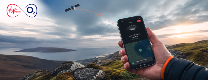
NTT Reinvents GPS Accuracy for Real-World Use
If you’ve ever watched your location jump across a map in a dense city or disappear entirely in a tunnel, you’ve already seen the limitation of GNSS.
It works. Until it doesn’t.
A division of NTT is now pushing a more practical answer to that problem, combining satellite positioning with sensors and network data to make location tracking actually reliable in real-world conditions.
Through its enterprise arm, NTT Docomo has been upgrading its Mobile GNSS positioning service since late 2023. The focus is not on theoretical accuracy but on usability in places where positioning has traditionally failed.
Fixing the Gaps GNSS Leaves Behind
Standard GNSS systems depend heavily on clean satellite signals. That’s fine in open environments, but in cities, indoors, or around heavy infrastructure, accuracy drops fast.
NTT’s approach is to stop treating satellite data as the only source of truth.
Instead, it combines three layers:
GNSS data
Provides the base location from satellites.
RTK correction
Uses ground stations to refine that position, often down to centimeter-level accuracy.
Nine-axis sensor
Tracks motion, direction, and rotation in real time, maintaining positioning even when signals drop.
The key difference here is continuity. When GNSS weakens or disappears, the system doesn’t reset. It keeps tracking based on movement and corrected data.
That’s a much more realistic model for how positioning needs to work outside of ideal conditions.
Where This Actually Changes Things
This isn’t about improving navigation apps. It’s aimed at environments where positioning failure creates operational problems.
NTT is targeting sectors where accuracy and consistency matter:
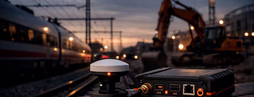
Construction
Precise positioning is critical for machinery, mapping, and automation. Errors translate directly into cost.
Rail
Train positioning needs to remain stable in tunnels and urban areas where GNSS alone struggles.
Energy
Inspection drones and infrastructure monitoring rely on accurate tracking in complex environments.
Public services
Emergency response and urban operations depend on reliable, real-time location data.
To demonstrate this in practice, NTT worked with TBS Television to track runners during a mini-marathon. It’s a controlled scenario, but it shows how the system handles movement, density, and real-time updates.
The SIM Decision That Stands Out
One detail that shouldn’t be overlooked: NTT moved from eSIM to a physical nano SIM in its latest receiver.
That goes against the direction most consumer connectivity products are taking.
But this isn’t a consumer product.
In industrial and aviation-related use cases, physical SIM still offers advantages. It’s easier to integrate into certified systems, easier to control, and often more compatible with existing hardware setups.
This highlights something the market doesn’t always acknowledge. eSIM is dominant in travel and consumer use cases, but physical SIM is still very much alive in industrial deployments.
Different layers of the ecosystem, different priorities.
Battery and Network Matter More Than Specs
The upgraded receiver also doubles battery life, which is not just a technical improvement but a requirement for deployment. Many of these devices operate in the field, often remotely.
LTE connectivity is another critical piece. It enables continuous communication and supports RTK correction in real time.
This is where positioning starts to look less like a satellite feature and more like a network-driven system.
Because it is.

This Isn’t Happening in Isolation
NTT is not the only player moving in this direction.
Companies like Trimble and Hexagon have been building high-precision positioning solutions for years, particularly in industrial and infrastructure environments.
At the same time, GNSS itself is evolving, with multi-constellation support and hybrid positioning becoming standard.
According to GSMA and broader geospatial research, demand for high-accuracy positioning is increasing as automation, IoT, and smart infrastructure scale.
What’s changing now is who is building these solutions.
Telecom players are stepping in, combining connectivity, positioning, and data into a single layer.
Conclusion
What NTT is doing isn’t about making GPS better. It’s about making positioning usable in the environments where it has historically failed.
That’s a different problem, and a more important one.
Compared to traditional geospatial companies like Trimble or Hexagon, telecom-driven positioning has a clear advantage: it’s integrated with the network. That makes it easier to deploy at scale and connect directly with IoT systems.
At the same time, it reflects a broader shift across the industry. Connectivity is no longer just about access. It’s about awareness.
Where a device is. How it moves. Whether that information can be trusted.
That’s where positioning becomes more than a feature. It becomes part of the infrastructure.
And once that happens, it stops being visible to users. But it becomes critical to everything that depends on it.