Travel Back in Time and Explore Cities as They Once Were
OldMapsOnline is not a traditional archive where you scroll endlessly through static scans. It is a purpose-built search engine for historical cartography, aggregating more than 500,000 digitized maps from institutions around the world. Behind the platform is a collaborative effort involving cartographers, historians, librarians, and volunteers who share a common goal: make historical maps accessible, searchable, and genuinely useful.

The scale alone is impressive. Maps span centuries, continents, and empires, from early Renaissance depictions of Europe to detailed urban plans from the 19th and early 20th centuries. Whether you are curious about colonial trade routes, shifting borders, or the evolution of cities, the depth of material available is unlike anything most people have encountered outside academic archives.
Trusted institutions behind the maps
What gives OldMapsOnline real credibility is its network of institutional partners. Collections are sourced from globally respected organizations such as the British Library, the David Rumsey Map Center at Stanford University, national archives, and university libraries across Europe and North America. These are not random scans uploaded without context. Each map is carefully catalogued, linked to its source, and presented with metadata that helps users understand its origin, time period, and purpose.
For researchers, educators, and even journalists, this matters. You are not just browsing pretty old images; you are working with historically grounded material that can be traced back to authoritative collections.
TimeMap and the power of visual timelines
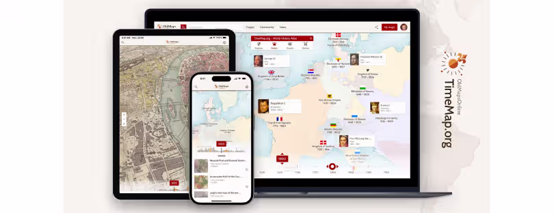
One of the platform’s most compelling features is TimeMap. Instead of treating maps as isolated artifacts, TimeMap lets you explore geography across time. You choose a location, slide through centuries, and watch borders shift, place names change, and regions transform.
This is where OldMapsOnline moves beyond being a digital library and becomes an interpretive tool. Seeing how Central Europe fragments and reunifies, or how coastal cities expand as trade grows, offers a kind of intuitive historical understanding that text alone rarely provides. For students and curious travelers alike, it turns abstract history into something spatial and tangible.

Multiple ways to explore the past
Navigation is refreshingly flexible. You can explore visually by zooming into a world map, search by typing a city or region name, or use time filters to focus on a specific century. For more advanced users, there are additional features that hint at where digital heritage platforms are heading.
OldMapsOnline supports side-by-side map comparisons, allowing you to place different historical periods next to each other. There is also 3D terrain visualization and experimental augmented reality functionality via its mobile apps, available on iOS and Android. These features are not gimmicks; they reflect a broader shift toward immersive history, where users are encouraged to explore rather than passively consume.
Why this matters beyond nostalgia
It would be easy to dismiss historical maps as niche content for academics. In reality, platforms like OldMapsOnline are becoming increasingly relevant in a world obsessed with data, location, and context. Urban planners reference old maps to understand city growth. Climate researchers examine historical coastlines and river paths. Genealogists use them to trace family movements. Even travelers use them to deepen their understanding of destinations they visit today.
For Alertify readers interested in travel, technology, and digital tools, this crossover is key. OldMapsOnline sits at the intersection of history, geography, and modern interface design, showing how heritage content can be reimagined for contemporary audiences.
Conclusion
When compared with other players in the historical mapping space, such as standalone institutional archives or platforms like Google Earth’s historical layers, OldMapsOnline stands out for one reason: aggregation with intent. Instead of locking users into a single collection or visual style, it acts as a gateway to the world’s most reliable cartographic archives while adding modern discovery tools on top.
This reflects a broader trend in digital heritage and travel tech. Users increasingly expect open access, interoperability, and intuitive interfaces, even for complex historical data. Trusted sources like the British Library, Stanford, and national archives are recognizing this shift, choosing collaboration over closed silos.
OldMapsOnline is not just preserving maps; it is redefining how we interact with the past. In an era where location-based services dominate everything from travel planning to connectivity, understanding how our world was once mapped offers valuable perspective. And the fact that this entire experience is free, accessible on web and mobile, makes it one of the most meaningful examples of how technology can democratize history without diluting its depth.