Never Get Lost Again: 6 Game-Changing Tips for Using Google Maps
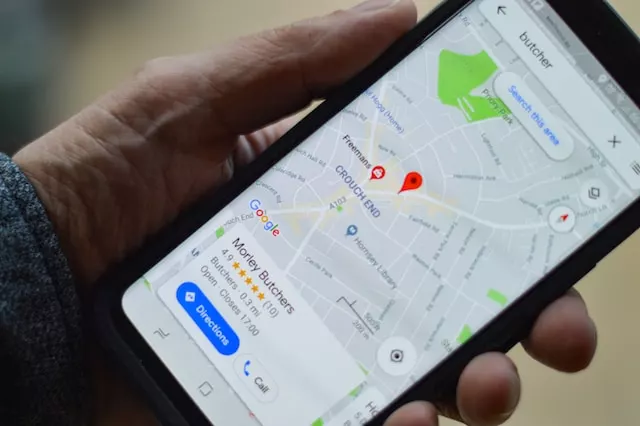
Google Maps has many useful features that can be taken advantage of, but not all of them are highlighted by the application. Discover some tricks that can make all the difference in your navigation around the city. google maps tips
Google Maps is currently much more than a simple navigator; it helps you find the best way to your destination. It is a gigantic directory with suggestions of places to visit, eat, or buy what we need. Even when used for navigation, the system is increasingly sophisticated, using technologies such as augmented reality that almost “hold our hand” to guide us to our destination. It’s a true Swiss army knife.
In this sense, there are some features that are not very well known but that can be very useful to help with navigation. From the possibility of offline navigation, the possibility of making distance measurements easily, or, of course, navigation assisted by augmented reality,
Here are some tips to further explore the potential of Google Maps:
1. Never get lost in real-time augmented reality directions google maps tips
As good as the route indications on a map are, there’s nothing like receiving directions in real-time through augmented reality. Google Maps has a feature called Live View, where you can lift your smartphone for the system to recognize the street and place arrows and other indications projected on the screen to point exactly where you need to go.
To activate the function, just click on the Live View icon in the lower left corner. The system will ask you to lift the equipment and analyze it, and from there, just follow the instructions. You don’t need to always point the device; if you lower it, it will automatically return to the map view. It should be noted that not all cities still support the feature.
2. Change the map icon google maps tips
Why not make the journey more fun when driving by changing the icon on the map? All you need to do is tap on the map position arrow to bring up options to choose between an SUV, a sedan, and a van.
3. Add multiple stops to your route
As much as we are used to using the map to trace typical routes from A to B, it is possible to establish different intermediate points that you need to stop at. You can add multiple destinations or stops, and the system ends up optimizing the best route to go through all of them.
To set the points, you will first have to choose the start and finish as usual. Next to where you define the location, click on the three dots of the options in the upper right corner. Choose the option “Add stop”. A line B will appear, used to define the address of the stop. You can add more stops before tapping “done”. You will see that the route gains a more complete itinerary.
4. Use Google Maps, even offline google mars
For situations in which you navigate in areas with poor network coverage or simply don’t want to waste your connectivity data, Google Maps has a feature to work offline. Or better yet, you can simply download the map to use later when you’re not connected.
To download the map, write the destination, then click on the three dots in the upper right corner and choose the option “download map offline”. You can also click on your profile picture and choose the “offline maps” option. If you don’t have any maps, you can select the city or country area you want to download.
5. Consult your travel history google mars
This is not a travel tool, but statistics. Whenever you use Google Maps, you create a history of the trips you take, the places you visit, and the routes you take, either to remember or check the time needed for travel. This timeline can be consulted later.
Just tap on your profile picture and choose the option “Your timeline”. You will have access to statistics on how you traveled, whether you went on foot, by car, or public transport. It also shows the map with the circuit, the places visited, the cities where it passed, and other interesting data. This is if you have no problems with privacy or automatic registration; otherwise, you can access the respective options, delete the history, and deactivate the automatic registration of movements.
6. Use Google Maps to measure distances
The PC browser version of Google Maps has a tool for measuring distances that can be useful if you are planning a course and need to measure it. Just search for an address, right-click on the map, and choose the “Measure Distance” option. You will then have to highlight two points, and the system will take the measurements immediately.
Take Away
In conclusion, Google Maps is a powerful tool that offers much more than just navigation. With its extensive database of places to visit, eat, and shop, and a range of useful features that are often hidden from plain view, it has become an indispensable app for many users. By taking advantage of some of the lesser-known features, such as Live View, multiple stops, and offline maps, users can enhance their experience and optimize their routes to save time and effort. Additionally, keeping the app updated and checking the availability of features in their region and the device can ensure that users are making the most of Google Maps. Overall, Google Maps continues to evolve and innovate, making it a valuable tool for travelers, commuters, and anyone navigating their way around the city.
Do not forget to keep the app updated. Google Maps is constantly being updated with new features and improvements, and users should ensure that they have the latest version of the app installed to take advantage of these updates. Additionally, it is important to note that some of the features mentioned in the text may not be available in all regions or on all devices. Users should check the availability of features in their region and device before trying to use them. google mars


